

Georgetown, Del., Nov. 5, 2013: Sussex County will join the Federal Emergency Management Agency in hosting a public meeting in early December for property owners and residents to review proposed changes to federally-mandated flood plain maps that could have implications on future construction and homeowner insurance rates.
The open house meeting will be held from 4 to 6 p.m. Monday, Dec. 2, at the CHEER Community Center, 20520 Sand Hill Road, in Georgetown. At that meeting, representatives of County government, the Delaware Department of Natural Resources and Environmental Control, FEMA and their mapping partners will be on hand to explain the proposed Flood Insurance Rate Maps (FIRM) for Sussex County.
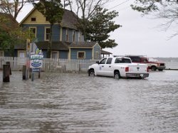
The maps, which identify flood-prone areas within the county and have been updated for the first time since 2005 using modern mapping technology and improved information, are used by insurance companies to determine flood insurance rates for buildings and contents.
Using interactive maps at the open house, representatives from the County, DNREC and FEMA will be available to answer flood risk and insurance questions, as well as explain the preliminary maps. Public comments and input received at the meeting will be reviewed by FEMA before finalizing the maps in mid-2014.
Flooding is the number one natural disaster in the United States; it is vital that property owners understand their risk and take advantage of tools or programs available to them, including flood insurance, said Jeff Shockley, environmental and flood plain manager for Sussex County.
“If you live anywhere along or within close proximity to a waterway or coastline, the FIRM maps can affect what, how and where you build,” Mr. Shockley said. “It is important for our residents and property owners to know where they stand, and how the maps can affect their insurance rates.”
Approximately 30,000 of the more than 136,000 parcels in Sussex County are within flood plains; because of the proposed changes, some properties may come out of an identified flood plain, while other parcels could be moved into a flood plain for the first time.
The maps are an update of the existing FIRM, which dates back to 2005. The FIRM and the associated Flood Insurance Study (FIS) are the basis for flood risk education and floodplain management measures. Sussex County is required to adopt updated maps to continue participating in the National Flood Insurance Program (NFIP) and make flood insurance available to the community.
As a result of the updates, some buildings in the county may, for the first time, be included in a high-risk flood zone, known as the Special Flood Hazard Area. This may result in mandatory purchase of flood insurance for those property owners who are affected. FEMA staff will be at the open house and will be available to talk to property owners about the updates.
Information is available on the County’s website at sussexcountyde.gov/firm. For more information, contact Sussex County Environmental and Flood Plain Manager Jeff Shockley at (302) 855-7884 or jcshockley@sussexcountyde.gov.
###